
Majoring in Space and Place
 Twitter
 Facebook
 Forward
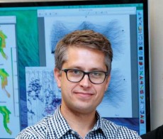
When Chris Bone looks out at the students in one of his geography classes, increasingly there is a new group looking back at him: computer science students.
It’s no surprise, given the course. Our Digital Earth covers the countless ways that technology allows us to use information tied to a geographic location. It’s all about smartphones, social media, mapping software. It’s as much computer science as geography.
The course, also taught by department head Amy Lobben, is an introduction to the exploding industry of spatial data and technologies, and students with backgrounds in both computers and geography are particularly well-positioned to succeed here. That’s not lost on those computer science students in Bone’s class.
“Before, we were explaining to students the importance of location-based services and geography,” said Bone (above), an assistant professor. Today, “they already know that. There are a lot of students who want to become computer and information science majors who are so interested in this whole world of spatial data and technologies. They see this connection between geography and computer science.”
The geography department is accommodating them by launching a new major: spatial data science and technology, which will teach students how to capitalize in an arena where the collection of data and the uses for it are expanding exponentially. Students can start taking courses now that count toward the major.
The focus, Bone said, “is to make students competitive in an industry that is calling for a lot more geographers.”
The major will serve students who want to learn the coding to run location-based computer programs. It will also cater to students drawn to spatial data analysis—that is, using location-based information to tell a story or find an answer. Everyone will get a taste of the latest spatial analysis software applications, which seem to emerge daily. And computer science students will have an easy avenue to a double major.
Students will learn what Bone calls “spatial thinking”: the ability to understand the heart of a geography-based problem, how to solve it, and—always an important question for scientists—how to present it clearly to the public.
“Companies have their software engineers,” Bone said. “Our students will have had enough exposure to programming to communicate with them. They can tell the programmers and engineers, ‘You need to develop this kind of application to solve the problem.’ We want our students to become the problem-solvers in these environments.”
The applications of spatial data and technologies seem endless.
Facebook leads the crush of social media- and Internet-based companies asking us to check in wherever we might be at any particular moment.
Census information shows where in the city incomes are highest or crime is lowest. Climate change? Analysts use spatial data and technology to tell you who is most vulnerable given where they live and what the conditions are today—or what they will be 100 years from now. Business? What company doesn’t want to know where its customers live or where they go, day-to-day?
One of the biggest growth areas for spatial data and technology is humanitarian applications. Satellites show advocates which regions in the world are experiencing conditions—environmental or political—that could lead to conflict. Aid organizations, meanwhile, use social media and mapping software to speed disaster relief to victims able to tweet their locations or post to Facebook.
In such life-or-death situations, success or failure can hinge on one’s ability to quickly grasp the lay of the land. But that’s what geography is, of course.
Said Bone: “Geographers have a cultural and environmental awareness that, coupled with knowledge about location-based data, make them very useful for applying these technologies in different parts of the world.”
—Matt Cooper